We can't find the internet
Attempting to reconnect
Something went wrong!
Hang in there while we get back on track
About This Trail
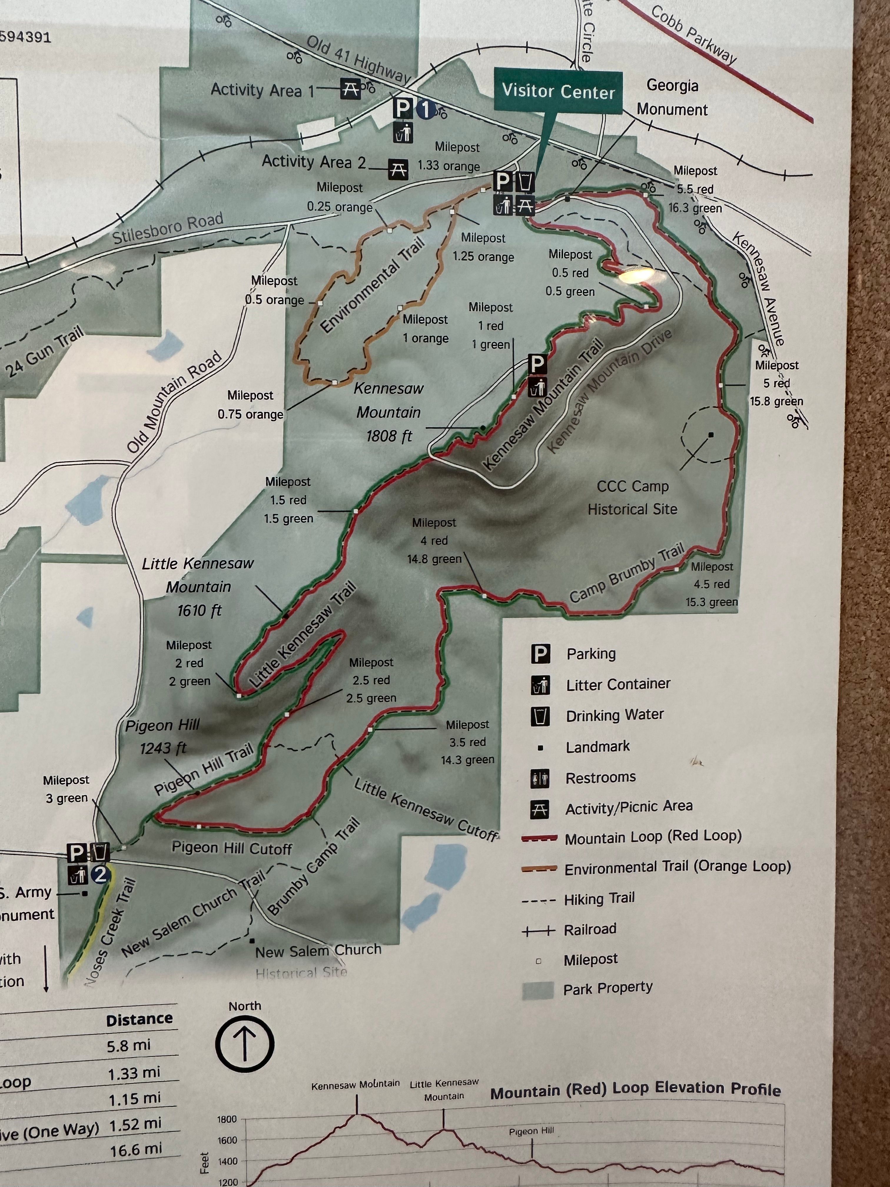
Big Kennesaw Mountain Trail climbs to the summit of the highest point in the Kennesaw Mountain National Battlefield Park, where Union and Confederate forces clashed in June 1864. The rocky path ascends through mixed hardwood and pine forest, passing preserved earthworks and artillery positions that witnessed some of the Civil War’s fiercest fighting. From the 1,808-foot summit, hikers are rewarded with panoramic views stretching from downtown Atlanta to the Blue Ridge Mountains on clear days. Interpretive wayside exhibits along the trail explain the battle’s strategic significance and human cost. The mountain’s location along bird migration routes makes it excellent for spring and fall birding. A paved road also reaches the summit for those preferring a less strenuous option.
Getting There
Trail Photos

Been to Big?
Share your experience and help fellow hikers discover this trail.
Write a Trail Report Report Conditions Upload Photo