Georgia
Union County
Blood Mountain Trail
Scenic hike up Blood Mountain
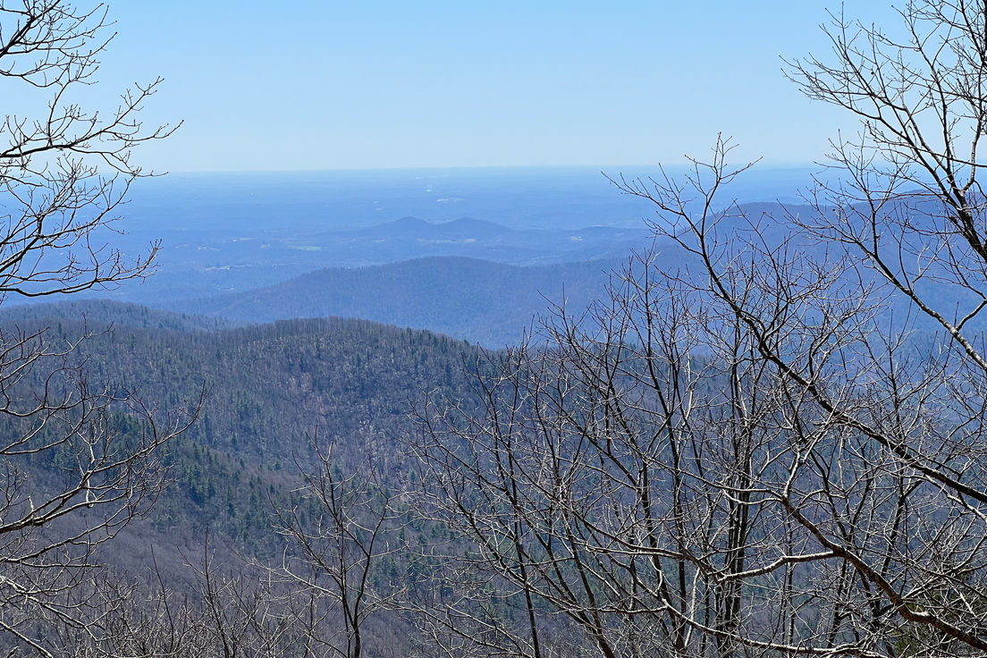
This trail to the top of Blood Mountain is an excellent hike and offers an amazing view from the top. The two and half mile hike to the top of the beautiful Blood Mountain is great any time of year, but a crisp fall day is especially nice.
This is part of the Appalachian Trail that takes you from Neels Gap to the Top of Blood Mountain. Starting at the Waleisi-Yi Center at Neels Gap, you will head South on the Appalachian Trail. The Trail starts across the street from the Walasi-yi Center. Parking is 1/4 mile North of the Walasi-yi Center, there is a strict 20 minute limit on parking at the Center.

The Walasi-yi Center was built by the Civilian Conservation Corps in the 1930's (completed 1937) and originally used as an inn and restaurant for the few brave souls who ventured this far into the wilderness. Today the center is hiker's paradise, here novice through trail hikers frequently stop and repack. They unload items they now feel are useless weight and spend the extra money to but gear that shave valuable ounces off the total. You need a strong will not to come out with some type of high tech backpacking gear so bring your wallet.
The elevation at Neels Gap is 3,109 feet and the elevation atop Blood Mountain is 4,461 feet, so the ascent up Blood Mountain is quite steep, especially the last mile, gaining most of those 1350 feet. The first mile is easily walked and after the first mile you will come to the junctions of both the Freeman Trail and the Byron Herbert Reece Trail. The final mile traverses short and steep switchbacks quickly gaining altitude.

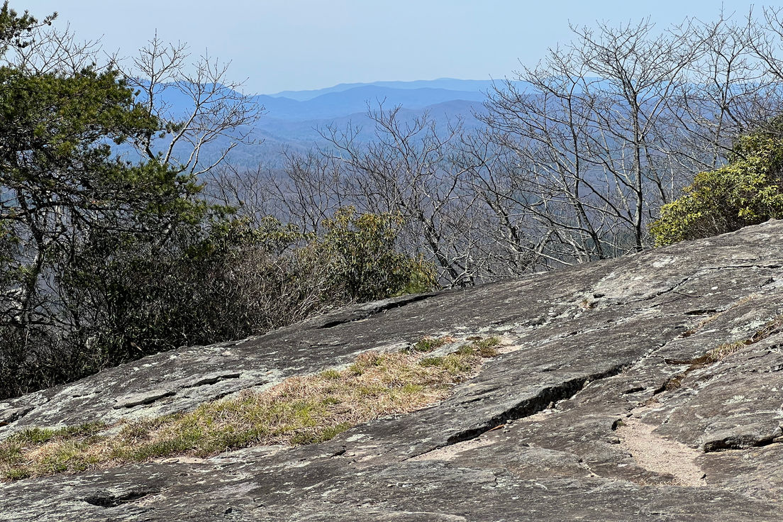
The summit of Blood Mountain is the highest point in Georgia of the Appalachian Trail. The famous stone shelter on top of Blood Mountain was built by the Civilian Conservation Corps (CCC) in 1934. The Blood Mountain Shelter is a two-room stone shelter that is also listed in the National Register of Historic Places. Picnic rock is also a famous landmark on top of the mountain.
Length: 2.5 miles
Difficulty: 6
Nearby Trails
Byron Herbert Reece Access Trail
Formerly known as Blood Mountain Spur Trail
Freeman Trail
Connects to the Appalachian Trail on each end
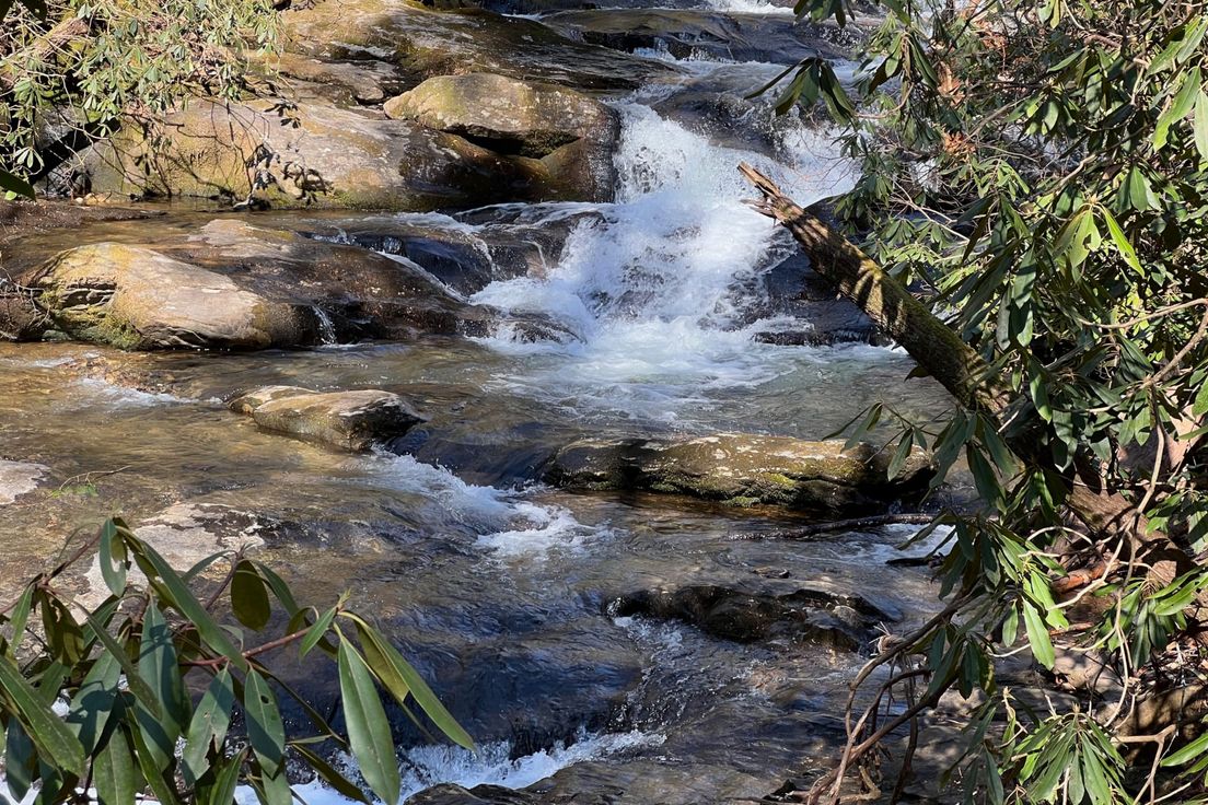
DeSoto Falls Trail
Trail to two beautiful waterfalls
Bear Hair Gap Trail
A trail that winds through Blood Mountain Wilderness
Coosa Backcountry Trail
A long loop in the mountains in and around Vogel State Park
Day Hike
I started out at the Mountain Center to see all the gear they have, it's a hikers treasure chest for sure. I ended up getting some water and Clif Bars. I moved my car up to the Trail Head Parking, which is really for the Byron Herbert Reese Trail which intersects the Blood Mountain/AT Trail. I parked and walked the 1/4 miles south to the Mountain Center, crossed the road and headed up Blood Mountain. There is a Rock Garden about a mile in that has interesting rock formations. I met several other hikers that had started out from Springer Mountain on Thursday (they looked pretty beat). The last mile is tough with the elevation gain, but the view is spectacular. I thought about continuing on to Slaughter Creek Gap, but ran out of time. All in all it was a great hike, and would do it again. This is not a kid friendly hike, because of the difficulty.
Day Hike
A pretty strenuous hike for beginners, however, the views are worth every step. The first mile (from the parking lot to the trail intersection) and the last mile (the final summit on the rocks) were the most strenuous for us. We passed many people older than us (we are in our mid twenties) and many children- all seemed to enjoy the hike. It was a busy Saturday and the parking lot definitely fills up. Overall, I would highly recommend this hike. Just make sure to bring plenty of water, and pack lunch for a great meal at the top. Also be sure to stop by the very well equipped mountain shop/outfitter either before or after your hike.
Day Hike
I would rate this as moderately strenuous. The author mentions that the first mile is easily hiked. I feel that he/she possibly used a previous trailhead as the Byron Reece parking lot looked fairly new. I would have to say the opposite - there was a section in the first mile that was a pretty decent climb. My heartrate went up, for sure! There is a lot of rocks/boulders on this trail which required some navigating and some high stepping. The vistas are beautiful, and the shelter was really cool to look at. It's a popular trail, so don't go out for solitude.